April 19, 2009
NATURAL BRIDGES NATIONAL MONUMENT, outside Blanding, Utah
GRAND GULCH
GOOSENECKS STATE PARK
MONUMENT VALLEY
Left a beautiful, sunny, 38-degree Durango for Utah. Luckily got the last of the only 13 spaces at this small campground at Natural Bridges. Took a 3-mile hike past washes, bridges and rock art in 70 degrees that felt warmer climbing 500 feet in jeans. The next day we drove down the road to Grand Gulch Ranger Station, Kane Gulch, and after a chat about the wet conditions at Grand Gulch, decided it would be better to hike Mule Canyon. Fabulous day for a hike, birds chirping, ruins very well preserved under an overhang; we continued along a stream bed, until we turned around about 2.5 miles in. Must go back there someday and continue; other hikers said there’s more ruins back in there. Next we drove over to the Comb Wash for a look-see, then went across the street to Arch Canyon for a hike. It was very hot, but an amazing ruin. The next day we did Grand Gulch, another amazing hike: climbing around slick rock, seeing ruins, complete with little tiny corn cobs still there, walked along the wash. We got as far as a small arch, about 6.5 miles in. Looked for Wetherill’s signature, but no luck; should have researched it better first. Quite a hot hike out and we were low on water (and what we had was now hot) so very glad to make it out while hallucinating about jumping into ice cold swimming pools… swollen legs the next day tells me I pushed it too much. Total hike about 12.5 miles. There was a meteor shower that night but only B took a peek; I was out. The next day we left Bridges and drove south to Goosenecks State Park, past Grand Gulch, and on down the Moki Dugway. All accounts on-line said it was a scary road, but it was totally fine, no problem at all, even with the trailer. Incredible scenery as the valley floor opens up to the unusual formations, such as Valley of the Gods and Monument Valley further south. The campground is RIGHT ON the rim of the canyon, the San Juan River flowing below. WOW. Many pics. The next sop was Monument Valley, great gift shop and new hotel, all new since our last visit. Did the 1- mile driving tour in the valley, seeing a dog leading a pack of sheep or goats through the land, looking thirsty… killing me… Very windy and dusty drive home, stopping at the Tees Nos Pos trading post for wool of course. Score!
 |
| Keeper of Arch Canyon |
|
 |
| Arch Canyon 800 year old corn, I guess. and little ears they were. |
 |
| Signed by the author. |
 |
| Really? a shell??? Arch Canyon. |
 |
| Anasazi at rest. |
 |
| Ruin in Grand Gulch |
 |
| The HOT hike out. 12 miles and hot. |
 |
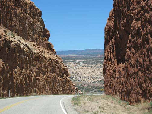
| Everything we read made this sound scary. But it was fine. Seems the road had been improved from what we read. |
 |
| But it opened to a grand view. This is heading south, toward Monument Valley. But first: Goosenecks |
 |
| (I guess he trusts me...) |
 |
| Valley of the Gods below the Moki Dugway |
 |
| Roaming free, being lead by a thirsty-looking doggie. killin' me... |
 |
| Beauty and the beast. |
 |
| Monument Valley |
 |
| The butt rock I left behind. |
 Info: On a tree-covered mesa next to deep sandstone canyons, three natural bridges formed when meandering streams slowly cut through the canyon walls.


No comments:
Post a Comment