
SE Arizona:
• Dragoon Mountains/Cochise Stronghold
• Chiricahua Mountains east side
• Dragoon Mountains/Cochise Stronghold
• Chiricahua Mountains east side
SW New Mexico:
• Silver City
• Gila Wilderness
• Caballo State Dam Park
• Ruidoso/Alto
• Albuquerque (Cheap Trick)
2,000 Miles Total • Silver City
• Gila Wilderness
• Caballo State Dam Park
• Ruidoso/Alto
• Albuquerque (Cheap Trick)
Monday, Mar. 6 -- Wild Horse Pass Casino for the last time...
 |
| Snagged the end spot. Filled up fast there in the casino parking lot. |
 |
| And there you will find us... |
 |
| Farewell dear friend, you have started us well many a morning. |
 |
| Camp Cochise Stronghold, spot #9 |
 |
| Dutch Oven Lasagna, it was good! |
Got an early start out of the parking lot and on to the east side of the Cochise Stronghold in the the Dragoon Mountains, Coronado National Forest, elevation 5,000 feet. Got there early, and good thing, there weren’t many spots left in a very small national forest campground at the base of the mountains. The story is that Cochise was buried somewhere up here in the rocks in the 1870s, but has never been found. I see why, rocks and rocks and more rocks. The camping area had only about 10 spots and we got #9 (no electric here). Arrived about noon. Beautiful area once you are in it -- from a distance it just looks like rocks. NOT. The campground was around a central area covered by oaks which -- oh fun -- were filled with several acorn woodpeckers! And friendly too. I had raw peanuts with us so I was their best friend. At one time I counted 6 at once but still not sure of the actual count. Then came the big boys, the scrub jays, barreling in, flapping their noisy wings, hogging all the nuts. But the sweet acorn boys clung to the sides of the trees venturing in every closer for the morsels (I broke them up into small pieces). They flew down trip after trip to take a piece and stash them up the the tree knots. I bet if we stayed a little longer they would be eating out of our hands. They were already coming within a foot or two of us. We've happened upon an incoming cold front (32 at night!) so I like to think a little peanut oil kept their inner furnaces burning... Beautiful weather today though, in the low 60s, sunny and windy at times. Hung around camp today; tomorrow we'll hike. Having too much fun shooting the birds, if I can say that. Made Dutch Oven lasagna this night and it was dang good. Easy and good.
 |
| Heading to the Stronghold. Who could tell from this distance it would be beautiful woods up there. |
One of the most famous Apache leaders to resist westward expansion by white settlers was Cochise of the Chiricahua Apache. Cochise, who was described as a large man (for the time), with a muscular frame, classical Roman features, and long black hair. In 1850, New Mexico and Arizona were annexed by the United States, which ushered in a brief period of relative peace. For more than a decade, Cochise worked with the new settlers and even helped them by teaching them how to live on the dry, arid land. However, the tenuous peace would not last when, in 1861, an Apache raiding party drove away a local rancher's cattle and kidnapped his eleven-year-old step-son. The rancher, John Ward, believed Cochise was responsible for the raid and demanded that the military confront the Apache leader to recover the boy and livestock. (It would later become known that it was a different band of Apaches who'd done the raid, not Cochise’s.)In 1862, however, an army of 3,000 California volunteers under Gen. James Carleton marched to Apache Pass to reestablish communications between the Pacific coast and the East, putting the Indians to flight with their howitzers. [See Trip #34, Fort Bowie] Upon the death of his co-fighter Mangas Coloradas, Cochise became principal chief of the Apaches. From that time on a war of extermination was waged against the Indians. Cochise and 200 followers eluded capture for more than 10 years by hiding out in the Dragoon Mountains of Arizona, from which they continued their raids, always melting back into their mountain strongholds.In June 1871 command of the Department of Arizona was assumed by Gen. George Crook, who succeeded in winning the allegiance of a number of Apaches as scouts and bringing many others onto reservations. Cochise surrendered in September, but, resisting the transfer of his people to the Tularosa Reservation in New Mexico, he escaped in the spring of 1872. He gave himself up when the Chiricahua Reservation was established that summer. Before he died, Cochise had requested that he be buried in an unmarked grave so that the white man would not find his body. One account says that he was buried along with his favorite horse and dog in a deep rock crevice in Stronghold Canyon. Another version tells that he was buried several miles east of the Stronghold, and that his warriors then galloped their horses over the grave so it could not be identified. In any event, the location of his burial remains a mystery today.


Thursday, Mar. 8
Today we hiked the 6-mile Cochise Trail. Nice hike, not hard (as in climbing), through the lush areas of the Stronghold. I see why they liked it here. Finished the hike early by 2pm (and got a cell signal up there so was able to make phone calls), did some work (yep, the w word), and had a hearty steak and 'tater dinner. Ate like Mountain Men. Watched a DVD on the Trail of Tears and hit the hay early, after knitting (as always).
 |
| View looking east from the trail. |
 |
| The halfway point; now we turn around and head back. Could the day be more perfect? I don't think so. |
 |
| Entering the Chiricahua Mountains camp; uh-oh, here we go again... |
Left Cochise at our standard morning time: 9:30. That just often seems to be our departure time without trying. weird. Had fed my fave little acorn woodpecker a bit earlier, and pulled out of the campground as he perched on the edge of the picnic table wondering where I was going. He sure hated to see us go. Today we headed to the east side of the Chiricahua Mountains, getting there by way of New Mexico--the road though AZ is not paved all the way and we didn't want to rattle out our aluminum--through Lordsburg and Portal. It is super windy today, so driving directly into the east wind averaged us 6 mpg. Of the three
 |
| Heading south to the mountains. Open NM land, good to see. No wonder the aliens (space) come here. |
campgrounds we chose Sunny Flats. And so did everyone else. There were even two cars there from Cochise. Again, we got one of the last few remaining spots (no electric). This place is beautiful and reminds me of Zion, with tall canyon walls on each side. Once again we got one of the last spots having arrived about 2:30, #5, elevation about 5200'. As we were setting up I stepped out of the door, turned right in a hurry and tripped over the parking bumper thereby doing full body-plant into the dirt. Ouch, my toe, my ankle, my knee... a shoe missing... (stop laughing). I limped to the truck, bloodied, with the awaiting husband saying he saw the whole thing and was laughing, until he saw how slow I was to get up. Gee, thanks a heap. Now I see I've ripped the knee on my pants, and tho I was wearing my knitted cotton mitts (it was 42 windy degrees on arrival), I somehow (and still don’t know how) cut the palm of my left hand -- and the glove is fine. wut tha? No damage to the mitt. huh? still I don't get it. As always after setup, we got back in the car to explore as it was too late to start a hike. Drove around and came upon the Southwest Research Center which had a gift shop, which was closed, but they also had a sign that said they have Mata Ortiz pottery there (which we had just learned about at the Durango film festival through a documentary). Someone was in there, let us in, and well, I walked out with two pieces. Bet they were glad they let me in… On we drove up the mountain a bit, walked on a short trail. Looks like weather is moving in, and so they said on the radio. But the sun managed to poke through to light up the canyon walls for a sunset show. Tomorrow we’ll hike the South Fork Trail. We heard it’s the best spot for birding.
 |
| This road to the camp will look a lot different tomorrow, as you will soon see.... |
 |
| Bill not happy. It was chilly out, so it was a short walk. |
 |
| A beautiful sunset |

Mata Ortiz is a small village on the high plains of northern Mexico. As a young boy, Juan Quezada was intrigued by the designs on the ancient pottery shards he found while gathering firewood to help support his family. The shards and rare whole pots came from a civilization dating from approximately 1000–1500 A.D. centered in nearby Paquimé (in the present day town of Casas Grandes), which traded pottery and other items with peoples from the Pacific to the southwestern United States and down into Central America. Juan theorized that the ancients must have created their pottery from local materials and set out to rediscover their methods. He found local clay deposits and minerals to use for paint. By a process of trial and error he learned how to process and shape the clay so it would not crack during drying and firing, how to paint the fine lines using a brush made from human hair (often from his own children), to finish the pot with a high shine and to fire it using simple, readily available materials. Meanwhile, in 1976, anthropologist Spencer MacCallum found three pots in a swap shop in Deming, New Mexico. Initially he thought they were ancient, but when closer inspection revealed their contemporary origin, he set out to find their maker. Eventually his search led him to Mata Ortiz, an impoverished little town in Mexico on an isolated dirt road, seemingly in the middle of nowhere. It was there he found Juan Quezada and when Juan brought out similar pots he knew his search was over.
And now with the cartel crime, most people are afraid to cross the border to Mexico to shop for it directly, so glad I found it here. Actually it’s quite attainable here out west and online, I have since learned. So I’ll keep looking, love the hunt. Just had to jump on the bandwagon!

Woke to SNOW! 30 degrees and the world has turned white. The radio says this could go on until tomorrow. Nothing left to do but drive back to the cafe back in Portal. At least there we could have some (more) coffee and wifi. OK, now what… It was still iffy, so we drove some more, toward the north a few miles to look around, again, neat area. We cross the AZ/NM border on the road coming in to the mountains. By 2:30 it had cleared up enough to get out on the hike to South Fork. Nice hike in the woods with a stream running through it, and GREAT rocks!

 |
| The road looks a little different this morning. |
 |
| Down to four layers now at 9 am. |
 |
| Some great caves on those cliffs. |
 |
| On our HIKE???? |
 |
| I could have spent DAYS looking at all these rocks. |
 |
| Border Patrol on the rounds, on the trail... |
 |
| Looked like fall in there. |

 |
| Later that same day... |
 |
| The skies were blue again and the snow was gone. |
 |
| And that's why the west is bitchin' |
 |
| Sights along the next stop at Gila National Forest. |
 |
| He actually got gas out of this in Mimbres. |
Today is daylight savings time, but not here in our camp: it’s AZ, remember? I bet the neighbors wish we knew that when Bill cranked up the generator at 5:30 am. But the batteries were so low from the heat running all night he did it anyway. I doubt anyone noticed under their blankets... Again an early start for our next move. To get to the Gila National Forest we’d go through Silver City & Mimbres, NM, new territory (which means no knitting in the car, gotta scope out the sights). Must have been some major mining in this area; the mountains are taken apart! Lots of terracing. I’ve read it happened in the 1880s of course, gold and silver, and also this is where Billy the Kid lived as a kid. His mother is buried here but we didn’t visit her (only because I didn't know at the time; I would have!) On the way we thought the trailer might have had a hose break, as we noticed during a stop that water was leaking out, but after a water test at the Silver City KOA (who were kind enough to lend us a hose) everything seemed fine. So because of this delay we were a tad later getting to the next campground, which did indeed cost us an electric spot! darn! But even so, we have the

 |
| Tyrone mine area near Silver City. Not a good look for the mountain. |
Some info on Silver City:
Silver City was founded in the summer of 1870. The founding of the town occurred shortly after the discovery of silver ore deposits. Following the silver strike, streets were laid out, and a bustling tent city quickly sprang to life. The town had originally been designed with the streets running north to south. The town was also built in the path of normal water runoff. Businesses sprang up and people learned to deal with the inconveniences of the summer rain. Silver City was built with high sidewalks in the downtown area to accommodate high flood waters. Meanwhile, uncontrolled grazing thinned down plant life on hills surrounding the town. During the night of July 21, 1895, a heavy wall of water rushed through the downtown business district, leaving a trail of destruction. A ditch 55 feet lower than the original street level was created in what was once known as Main Street. Businesses on Main Street began using their back doors on Bullard Street as main entrances and eventually, were permanently used as the new front entrances. Main Street now ends near the back of the Silver City Police Station, where the Big Ditch Park begins. [missed that] The town's violent crime rate was substantial during the 1870s, Grant County Sheriff Harvey Whitehill was elected in 1874, and gained a sizable reputation for his abilities at controlling trouble. In 1875, Whitehill became the first lawman to arrest Billy the Kid, known at the time as William Bonney. Whitehill arrested him twice, both times for theft in Silver City, and would later claim that Bonney was a likeable kid, whose stealing was a result more of necessity than criminality. His mother is buried in the town cemetery. The Anasazi Indians once lived in the area. They predated the Apaches by several hundred years. Pot shards can still be seen at various sites throughout the surrounding area. Beads, arrowhead pieces and pot shards were once visible, scattered all over the hill above the old hospital. Early cowboys often used the exposed ancient pots for target practice and many archeological artifacts were sadly destroyed. This happened during the time when major conflicts occurred between the Apache Indians and local settlers, when anything "Indian" was considered something to be destroyed. [AGH!]
 |
| Chilly view out the door. But what a great spot! |
 |
| No, we don't travel with a cat; those bumpy roads take a toll. |

19 degrees this morning and the sun is shining. Bill did the rounds to see if anyone was leaving but no one is moving very fast and we’re not going to sit around and wait for them to pack, so off we go to Pinos Altos and Silver City to see the sights. Took the winding road we couldn’t take the trailer on back down toward Pinos and SC, beautiful tall pine drive but a workout for Bill’s guns; some tight curves. Saw some deer and javelina. Pinos looks pretty populated this time round but not sure how much I can remember from 37 years ago. Back then I’d say it was my first ghost town visit. Anyway, took some pics of the mercantile which I do remember, as well as the opera house and other building there. Visited the old cabin museum across the street and with the purchase of my T-shirt I was welcomed into the museum in the back! Old, old, old dusty stuff from the area and not much time to check it all out. The proprietor followed me through and told me he lived in Durango in the 70s but came back to here because family is here -- going back to the 1860s! That’s why he had the cabin, the artifacts, and even did some Mimbres pot digging back in the day which were on display. Before long Bill came along and ushered me out; we’re always in a hurry. Speaking of the 70s, Bill needs some quaaludes to slow it down, enjoy the ride and the view. But no, time to move on. Down the road to Silver City. OF COURSE many of the shops are closed on Monday, but we walked around the main road and had a delicious Mexican lunch at Nancy’s Cafe on Bullard Street. Some youngsters down the road recommended it. Good choice. There are many galleries here too and did get to see some local work. And it warmed up to 66 degrees -- felt hot! One man in the bead-estate jewelry store told me this coming weekend is the Santa Fe bead show! what??? I'll work on that addition to the plan. Do need to come back again, I like this place. Bet I could score some quaaludes off those youngsters too… Didn’t get back to camp until about 4pm, too late to move and no spots open anyway. So we took a walk on the Purgatory/Chasm Trail which takes you across the street and into a beautiful canyon! Who knew? We just walked along and there it was. Again, rocks and rocks and rocks--could have spent hours looking for hearts. Had some colorful ones there to, like terrazzo. Also a sign saying Mexican Gray Wolves have been reintroduced into the area. Didn't see any. With the extra hour of daylight we didn't eat until 8 and tried to figure out where to go tomorrow. Two nights, time to go. Should we take the western Datil route or the safer Socorro route? I’ll know tomorrow….
 |
| Pinos Altos cabin store and museum |
Back in the 1860s, three prospectors stopped for a drink in Bear Creek and found gold in this area, which sits off N.M. 15, six miles north of Silver City and 244 miles southwest of Albuquerque. Over the next 50 years the strike eventually yielded some $8 million worth of gold, silver, copper, lead, and zinc, and turned these forested hills into the town of Pinos Altos, with saloons, hotels, and an opera house. The village, with a population of some 300 people, is full of historic buildings—most dilapidated, but a few still operating as homes and businesses.
Most evident among them is the Log Cabin Curio Shop and Pinos Altos Historical Museum, built in the 1860s. Once the village schoolhouse, it’s now a funky little treasure tended by George Schafer, whose grandfather built it. George shows me memorabilia ranging from an old sewing machine to gold pans to a cross said to have helped calm differences between settlers and Apaches. Many of the collectibles come from his family.
 |
| Pinos Altos. Apparently these places still operate but we didn't get inside. |
 |
| The place I remember most on my first visit in 1975. |
 |
| The same building in 1975. Look what 37 years can do to a pine tree! (and a tin roof) Photo courtesy of the T. Family archives, Grasshopper-Apache Division. |
 |
| Silver City Elks Lodge: Now THAT's a gargoyle! |
 |
| Silver City |
 |
| At Nancy's Cafe in Silver City -- good stuff! |
 |
| Silver City old coffee shop. coooool. |
 |
| Silver City: Waiting on their man... my possible lude connection.... the white one was really worried. |
 |
| Back at camp at Lake Roberts: Does anyone ever spell check a trail sign? |
(to be continued...)
 |
| Would we see the curious wolf on this trail? |
 |
| Could this be the poop of the curious wolf? |
 |
| Isn't this the happiest rock you've ever seen? |
 |
| Doesn't that look like a rock face on the right waiting to eat Bill on his trail? (and doesn't that look like Richard Nixon's profile up on the left wall?, as someone pointed out to me after posting) |
 |
| And now it's happy hour -- time for cheese and quackers! |
 |
| Percha Dam State Park, #18 - with electric! |
18 degrees this morning, time to move on. Definitely need to come back to this area when it's a little warmer and not spring break. Left at 9:30 am (of course). Decided to go the Socorro route because the Reserve-Datil route to the west could be rough road, we just don't know. Turns out our way out to the east was pretty wild too! Another curvy road at 8000 feet that went through more old ghost towns like Hillsboro and Kingston, but of course we didn't stop. Wasn't much to stop at anyway. But it went fine and dumped us out out into an ancient lake bed near I-25 where it was warming up. Had three campgrounds to choose from and picked Percha State Dam, the smallest and 'southernest' of all and a good choice, south of Truth or Consequences and amongst farmland -- which was fine until later in the day when the farmer decided to plow his dirt. In came the dust! Upon entering the camp we were greeted by twin-braided Apache camp host Ernie DogWolf, he was a character -- and a great host. Here we would have electric! Chose #18 between more permanent campers who kinda live there, with PTSD. ok. This was near the Caballo Dam so a small stream ran alongside where it was supposed to be good birding but we didn't see a whole lot, tho we were only there one night so that's probably why. Ernie said to take lots of photos -- but it will cost $2 if I want one of the Indian! Drove around as usual after setting up, went to town for food and wandered around until dinner time. Got some bird pics but they were little ones. Had electric so enjoyed some knitting and TV!
 |
| Darn. Plow dust day. |
 |
| Billboards work. Never heard of this, until now... |
 |
| The bosque near the camp. Good birding area. |
 |
| A nest among the willows. |
 |
| In case you ever wondered what happened to Mrs. Partridge. She's fallen on hard times. |
 |
| Road to Ruidoso, heading east. Trinity's on the right. |
33 degrees this am! but sunny. Left early; Ernie saw us off, and said may the Great Spirit be with us. This area around the interstate isn't very pretty, quite desolate actually. Great to the west and east, just stay out of the center of the state. We've decided to check out Ruidoso so we will head north then east. Bill read that the best Green Chile Burger in the Country (well, that's a big claim) is at the Owl Bar in San Antonio, the exit we need to head east. Perfect. It was good. It was an old bar, packed with families too, dark and quick. Back on the road. Our route would take us north of the Trinity site where they detonated the world's first A-bomb. Good place to do it I think. Not much out there. We camped at a small, private full hook-up place in Alto called Elk Run. Very nice, like camping in our own yard, same landscape. Set up and after cooling our jets we drove into Ruidoso to look around. A busy town, and full of Texas plates. Makes me forget which state I’m in. Tonight we'll eat in, tomorrow we'll go, what else, Mexican. There's about 10 to pick from.
 |
| San Antonio's Owl Bar. Worth the exit for the Green Chile Cheeseburger. |
 |
| Camping in Rafter J. I mean Alto, at Elk Run. |
 |
| FYI -- A nice fixer-upper for sale at Bonito Lake. Anyone? |
Today is hiking day. Went to the Forest Ranger Station and chose to hike at Bonito Lake. Nice area, but kinda boring with just tall pines (I like a good canyon!). Did the Argentina Trail, and it was still very snowy and icy on the trail in spots. Enough to make one slip and fall… again… Enough of this crap, I don't do inclines or declines on ice very well (I thought he was going to slide into the creek too!), so we turned around and went at the hike from the other end. It was pretty clear most of the way, but uphill. Not real exciting but we got some exercise. Came home and while getting cleaned up for dinner out tonight Bill called me out of the trailer: a small herd of deer were just on the other side of the barbed wire fence checking us out. They were quite curious, seems they've been fed before. And I had some Romaine… Soon there were even some on our side of the fence. Regulars I guess. Went to dinner at Casa Blanca, now called Casa Blanda. Good chips and salsa, margs were ok, but the food was totally tasteless. Bet they were sorry they asked; I told them and declined a dessert to make up for it. Even I was adding salt to it! Oh well, live and learn.
[Have you noticed the stories are getting shorter? I’m witting this from memory after returning home, not all the detail as when I type on the road.]
 |
| Argentina Trail, hike part 1. Too slippery. |
 |
| Hike Part 2. Better but bor-ing. Big trees down tho, lots of them. Recent strong winds? dunno. |
 |
| Yep, he touched it. It wasn't loving it. |
 |
| Pretty fearless. |
 |
| Now on our side of the fence, stalking us... |
 |
| The guilty have been pixelated... |
Leaving Ruidoso today, but not without a trip to Lincoln, home of the Lincoln County War (LCW). There was not a Billy the Kid shirt to be had in Ruidoso so hoping to score one at the source (turned out to be slim pickin's but got one). Not sure about Ruidoso… guess I'd go back but not during Spring Break. Now Lincoln on the other hand -- Fab-u-lous! They told me it's the most original ghost town left in America, or something like that. I think I may have to agree. Old historic adobes line the (paved) street, it was quiet, cool, early in the day and we couldn't have picked a better time to explore. Several museums help you understand what happened there -- it's a confusing story with so many involved. But for you, my valued reader, I've lifted some copy off the web to help make more sense out of it. Now pay attention and the photos following will make more sense:
The Lincoln County War is a complicated and murky conflict in many ways, but at its core, it was a clashing of two factions’ greed, violence, and personal hatreds.
-- On one side was “the House,” led by Lawrence Gustave Murphy and his violent business partner, James J. Dolan. By 1877, the House had had an economic and political monopoly on Lincoln County for years. The House ran a store which extended lines of credit no one could repay, permanently indebting purchasers. The firm also had control of the government contracts to supply beef to the Mescalero Apaches. The amount of beef the House told the government it supplied and the amount it actually supplied differed immensely, and always in the firm’s favor. The House of Murphy and Dolan was also intimately connected with the Santa Fe Ring, a group of corrupt politicians who ruled New Mexico.
-- On the other side were three influential men (and the "Regulators.") One was young Englishman John Tunstall who came to New Mexico planning to get rich by taking control of the county from the House. He wanted to take over economic power and began to do so by opening his own store and a bank. His associate in the bank was lawyer Alexander McSween who had earlier fallen into the House’s bad graces by embezzling a life insurance policy payout that the House had hoped to get their hands on first. When McSween met Tunstall, he saw someone who could fund his own schemes and persuaded the young Tunstall to go into competition with the House. The third man, also an associate in the bank, was famous cattle baron John Chisum who was hated by many Murphy/Dolan supporters. When the House could not get payment from Alexander McSween for the life insurance policy, they used dubious legal tactics to attempt to attach livestock from John Tunstall, operating on the premise that Tunstall and McSween were business partners (although the livestock was entirely Tunstall’s, not McSween’s).
-- After many legal maneuverings on both sides and heated confrontations, a killing resulted: On February 18, 1878, a posse of about 40 Murphy/Dolan men hunted down and killed the 24-year-old John Tunstall. This murder touched off the Lincoln County War.
-- Billy the Kid was on the Tunstall/McSween side of the war. He was one of almost 60 men who called themselves the “Regulators” as they intended to regulate justice to those who had murdered Tunstall. Billy was not the leader of the Regulators, although he was present at all the key gunfights of the war. After the war was over, the men who had been sympathetic to Murphy and Dolan needed a scapegoat; someone they could punish, and they chose Billy, partly because Billy was one of the few Regulators who had remained in the area. Billy was charged and convicted of the murder of Sheriff William Brady, the sheriff Jimmy Dolan had had in his pocket. There is no evidence to support Billy’s conviction – on the day Brady was killed, there were six men doing the shooting. Billy was one of them, but it is more likely that Billy was firing at Sheriff’s Deputy Billy Mathews, whom the Kid hated. Whatever the case, Billy was sentenced to death.
-- On April 28, 1881, Billy the Kid made a daring escape from custody (right here!) in Lincoln. During this escape, the Kid shot and killed Deputy Bob Olinger, a notorious bully who had previously tormented the Kid and threatened his life, and Deputy Bell. Billy rode out of the town and straight into legend. He was killed by Sheriff Pat Garrett on July 14, 1881.
Make more sense now? Now you know.
 |
| Driving into town from the south I first spotted this cool place. Now a B&B, Ellis Store B&B if anyone is interested, "a beautiful adobe, dating from the 1850's. Each guest room has a wood burning stove, antiques, fine linens, and hand made quilts." |
 |
| Montano Store. Love the after and before's. |

 |
| The Dolan Store and/or courthouse (still haven't figured all that yet) where Billy escaped, killing two in the process. They say he shot them from one of the upstairs window. I saw Kris Kristopherson do it from a balcony, but what do I know. |
 |
| Tunstall's Store. His house would be next door behind me but that's the one they burned to the ground. Definitely have to netflix Young Guns again. Here's the poop: Built in 1877. A focal point in LCW in which both partners were slain. Despite looting by Seven Rivers group, building continued as a store under pioneer merchants. |


 |
| In his own hand, and three more pages on display. By golly, that Billy the Kid was educated!! |
 |
| The courthouse museum had this enlargement set up to make you feel like Deputy Bell must have felt... uh-oh |
   |
| The Lincoln County Cat. Or, Kitty the Cat, Notorious Feline of Lincoln County. |
I could have spent a lot more time there, but you know, gotta go… So off we went toward Carrizozo, to camp at the Valley of Fires campground. And we got electric! #8. This is a peculiar spot on the landscape, here’s another interesting story for you:
 |
| The lava flow goes on and on and on. |
Valley of Fires Recreation Area is located immediately adjacent to the Malpais Lava Flow. Approximately 5,000 years ago, Little Black Peak erupted and flowed 44 miles into the Tularosa Basin, filling the basin with molten rock. The resulting lava flow is 4 to 6 miles wide, 160 feet thick and covers 125 square miles. The lava flow is considered to be one of the youngest lava flows in the continental United States.
[Another site says that this ]…originated from several nearby volcanoes, including one vent now known as Little Black Peak, 9 miles northwest of the dusty, windswept town of Carrizozo. The lava is called the Malpais (Spanish for 'badlands'), a name also given to several other flows in New Mexico, including the even larger deposits of the El Malpais National Monument near Grants, 130 miles northwest. [see Trip #26 for more lava. oh wait, I haven't done that one yet.]
 |
| The small facade of the No Scum Allowed Saloon. "Billy the Kid and Pat Garrett rode the streets of White Oaks back in the late 1800's when White Oaks was a booming gold mining town. Today not much remains of the town that was once the second largest town in New Mexico Territory." |
But the most important destination of all today would be the famous “No Scum Allowed Saloon” in White Oaks. We learned about this while in Tombstone so had to check it out. Nine miles into the hills to White Oaks and housed in a turn of the century brick building, the saloon itself goes back to the 1970s. We got there early (as in daylight) to find four other tourists (we’re all there for the T-shirt) and maybe 4 locals. The bartender gal told us that the Ghost Hunter crew was going to be investigating the building next door, gotta watch for that. Pounded down a few then I drove us (Bill had
 |
| Supposedly haunted, next door to the saloon. Watch for it on the show Ghost Hunters, I'm told. |
 |
| Small place, with signed dollar bills stapled to the ceiling. From their site: "When the building that had been a lawyer's and then a surveyor's office back in the Gold Rush days was opened as a saloon by Bud Crenshaw, bullet holes soon dotted the walls. White Oaks had a reputation of being a rough place to visit. The No Scum was the center of this rough place, and the people who frequented it were local cowboys and ranchers used to living hard and fighting hard." [but wait, I thought this bar started in the 1970s! bullet holes???] |


 |
| Bell's grave was unmarked for over 100 years, but was recently located and an impressive headstone erected. DEPUTY JAMES BELL and Deputy Marshal Robert Olinger, of the United States Marshals Service, were shot and killed during an escape attempt by the notorious outlaw Billy the Kid. |
 |
| (There is no explanation as to why her name is spelled "MacSween" on her tombstone.) SUSAN McSWEEN BARBER (December 30, 1845 – January 3, 1931) was a prominent cattlewoman of the 19th century, once called the "Cattle Queen of New Mexico," and the widow of Alexander McSween, a leading factor in the Lincoln County War, and who was shot and killed by members of the Murphy-Dolan faction. Susan McSween took over a large sum of land in the years after the Lincoln County War ended, establishing a ranch in Three Rivers, New Mexico. In 1880 she married George Barber, but later the couple divorced. By the mid-1890s her ranch holdings were some of the largest in the territory. She averaged during this time between 3,000 and 5,000 head of cattle, becoming extremely wealthy. In 1902 she sold her holdings to politician Albert Fall, and she moved to White Oaks, New Mexico, by that time a declining boomtown. She died there a wealthy woman, on January 3, 1931. |
 |
| All the old wooden markers. |
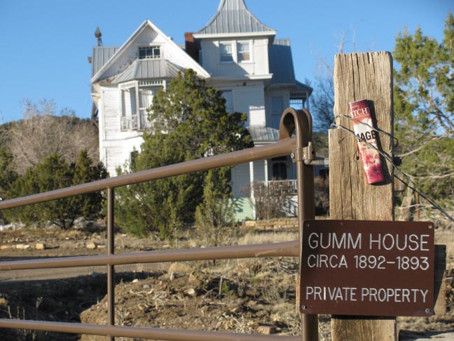 | |
| One of two mansions in town. "At its peak White Oaks had an estimated population of 2,500 and churches, a newspaper, a bank, opera house, lodges, saloons and well-stocked retail stores. Most impressive was the number of well-educated people who found their way to White Oaks. There was a great deal of cultured social life in this bustling mining town." and... GUMM HOUSE - Pat Garrett, Lincoln County Sheriff, was at the Gumm House arranging to purchase lumber to build a scaffold to hang Billy the Kid when the Kid made is famous escape from the Lincoln Courthouse. (good story, wonder if it's true) |
 |
| The campground area was lava-free as it was situated on an "island" above the flow. |
 |
| Ground Zero. |

 Saturday, March 17
Happy St. Patricks Day! Today we head to Albuquerque for the long-awaited (by me) Cheap Trick concert at the Route 66 Casino. But first -- the drive back, again across the desolation near the Trinity site but with a stop at the rock shop which says it has "trinitite", glass melted in the blast. Gotta see that. Well I did, but I had a lot more fun playing with the three cats there!!! In Albuquerque we visited Old Town (because it was the only place we could get a parking spot in town), this Trader Joe's was on the list. No where to park. What a bunch of hooey, who needs this and off we went to Old Town. Looks like Santa Fe and the bead show is off the itinerary as a big storm is moving in and we need to get this ton of metal home so we're not dragging it in snow. Concert was good but not long enough, just over an hour of the oldies and goodies. Home before 10! Well, what do you expect from 60 year old rockers? Stayed at Enchanted Trails campground west of Alb for easy access to concert, right along the interstate.
 Sunday, March 18
The weather is coming in, time to go. On the road by 7:30 am, home before noon from Albquerque! And the snow started to drift down as soon as we hit our driveway. Perfect timing. Beads? Maybe next year.
 |
| Albuquerque early morning. Time to head home. It's been a great trip. |
New Mexico Interpreter
White Oaks NM
March 23, 1888
Resident
C. M. Pearman, father of O. L. Pearman arrived in the city last Sunday to visit his son. Should he like our city, climate and business outlook he intends to become a resident. [saw this name at cemetery]
New Mexico Interpreter
White Oaks NM
March 7, 1890
Court warrant
Complaint was made before Justice McCourt on Tuesday by J. W. Thomson of Red Cloud, that Juan Padillo? And another Mexican were the recipients of his hospitality; on their departure appropriated every thing they could lay their hands on, also broke into a vacant cabin belonging to Jones Talleferro and took tools and clothing. Warrants were issued for their arrest.
New Mexico Interpreter
White Oaks NM
May 7, 1890
Illness
S. W. Lloyd, the cattle man, is no better, his case is a sad one. He is violently insane, and needs constant and the most watchful care. Only the other day he set fire to all of his clothing and he house, which was saved by the efforts of Mrs. Lloyd and the men about the place. The attention of brother Masons is called to Lloyd's situation. We are reliably informed that he is a member in good standing for the last 35 years, having joined the Brooklyn, NY Lodge in 1855. The financial conditions of the family, renders it impossible for Mr. Lloyd to receive the treatment he is in need of, hence this suggestion to the Masonic Fraternity, who doubtless are not aware of the actual state of affairs.
White Oaks Eagle
White Oaks NM
July 30, 1903
TEXAS PARK ITEMS
W. T. Bonine and family left Sunday for home in Crosby county Texas after two weeks visit at their sons, R.R. Bonine ranch in McMain canyon. Last Thursday evening while Mrs. N. B. Redding and Miss Lillie Harris were riding down Bernado canyon, they thought they heard a child cry and they answered it, a panther jumped from the rocks into the road frightening the horses and ladies badly. The panther followed them a short distance and went back into the hills.
The Outlook
White Oaks NM
Sept 22, 1904
Olga
At Deming on the 6th, Olga the eight-year-old daughter of Mr. Mrs. James Howlett, was accidentally killed while visiting the children of Pearce Rice. The latter were playing with a revolver and a few seconds after Olga reached the Rice home a shot was accidentally fired, the bullet passing through the head of Olga. Mr. & Mrs. Rice were absent at the time, and when men who heard the shot reached the house the little girl was hanging across a chair dead. The children had no idea that the revolver was loaded. The funeral of the little victim was largely attended.
The Outlook
White Oaks NM
Sept 22, 1904
Victim While excavating to place braces under the grand stand at the fair grounds in Albuquerque, workmen uncovered a human skeleton. The entire frame was taken from the earth, piece by piece and laid out just south of the grand stand. It was the skeleton of an adult whether native or white man none who saw it could tell. The skeleton may be that of some one who was the victim of a tragedy of the early days of Albuquerque or only the bones of one of the many criminals executed in the old adobe county jail and buried in the valley near by. The remains were taken in charge by the proper authorities and given a decent burial.
The Outlook
White Oaks NM
Nov 3, 1904
Bad Roads in New Mexico
The record breaking motor cycle cross country run from Denver to Albuquerque, made no records. Sergeant Capron and Private C. W. Bolen of Uncle Sam's army found New Mexico roads something too much for even their hardened constitutions to say nothing of the motor cycles and at last accounts they were hiking back toward Denver from Watrous riding on plush seats of a Santa Fe chair car, he motor cycles in the baggage car ahead. There was comparatively little difficulty until the men got across Raton pass and then the trouble commenced. An Albuquerque man who met the returning cyclists at Trinidad was told that in many places they had to make a detour of five files to get around a washed out wagon bridge and that at other times they had to carry the heavy machines for miles or drag them along. The machines they may stood the strain well but no machine they say could have stood the work through the washed out district south of Watrous. After looking over the situation from that point they wired to General Baldwin's adjutant to fix them out with transportation back to headquarters. It has been advanced that the time chosen for this run was not particularly propitious but even if this be true the use of motor cycles will be considerably discouraged in the army in the Colorado department, Albuquerque Journal.
The Outlook
White Oaks NM
Nov 3, 1904
Assault
An Albuquerque dispatch of October 22nd says: Fred Starr the Colorado baseball player and pitcher who assaulted Stella Henderson and in turn was shot by her returned to the city this morning and was arrested immediately as an indictment had been returned against him charging him with assault to commit murder. Stella Henderson was found not guilty at his trial last week.
The Outlook
White Oaks & Lincoln County NM
Dec 22, 1904
A Santa Fe dispatch of April 10th says:
Joe Vigil who murdered his wife at a dance at Raton New Mexico and for whom State Senator Casimiro Barela of Colorado presented a plea for executive clemency was today sentenced to life imprisonment by Acting Governor James W. Raynolds. Vigil shot his wife while in a jealous rage because Mrs. Vigil danced with another man, and though she pleaded for her life he shot her while in his arms. He fled into Indian Territory, but was captured and brought to New Mexico. He was to have been hanged Friday.
The Outlook
White Oaks NM
Feb 9, 1905
Some vandal with the light of modern civilization shining fall upon him but with an utter disregard for the rights of property has been appropriating with reckless lawlessness the windows of certain vacant houses situated around town. Even the windows of the school house over in the park have been stolen. It would not be amiss for some of the young ideas over there to shoot him wherever and when ever found.
The Outlook
White Oaks NM
May 18, 1905
Criminal Assault at Folsom
Folsom dispatch of May 7th says: Excitement is running high this evening on account of a brutal assault made by Juan Tucero at 10:30 o'clock this morning upon the person of the nine year old daughter of Henry Southern, foreman of the bridge work on the Colorado and Southern Railway. The little girl and her two smaller brothers were hunting flowers along the track about a quarter mile from the town, the Tucero seized the little girl and carried her into the rocks close by and brutally assaulted her. She fought the inhuman wretch striking him squarely in the face with a stone and leaving a wound that was sufficient to identify him by. The little boys ran to town as fast as they could and gave the alarm and officers and posses of men started out on the hunt for the man and soon ran him down. He was arrested and brought into town. Excitement soon began to run so high that the officers began to fear for the safety of their prisoner and hurried him out of town, where they have him in safe keeping. Southern was out with his men and came in as soon as he could, but did not get in until about 4:45 o clock this evening. Southern immediately armed himself and started out in the hunt for the officers and prisoner, and if he finds them there will be trouble. At this time Southern is still on the hunt for them.
The Outlook
White Oaks NM
May 18, 1905
The El Paso-Durango Railroad Company has filed plats for its permanent location in the Untied States land office at Santa Fe, from a point in section 5 township 16 north, range 9 west, in San Juan county, to a point on the township 11 north, range 10 west, between Grant station and Bluewater, a distance of forty eight miles. This completes the survey from Farmington, a distance of forty eight miles. At Farmington connection will be made with the Denver & Rio Grande Railroad.
The Outlook
White Oaks NM
June 8, 1905
Tome was Historic The town of Tome, swept away by the Rio Grande a few days ago was formerly the capital of the territory said was one of the oldest and most historic places in the territory. It was scene of a terrible massacre of Spaniards by the Comanche Indians 200 years ago. Its annual fiesta on Sept 7th was celebrated far and wide and attracted hundreds of natives who spent a week in merry making. At one time there lived there the flower of Mexican aristocracy, the Becas, Castillos, Oteros, Chaves, Salazars, Lunas, Romeros, Jimenez, Maldomas, Vallejos, Sanchez and others whose descendants are still leaders among their people throughout the Southwest.
The Outlook
White Oaks NM
June 29, 1905
Murder and Suicide -- A dispatch from Tucumcari June 14th says: Mrs. George Campbell the wife of a prominent ranchman living four miles west of here became insane suddenly last evening. Seizing a rifle she chased her husband away from home. Then before he could return with help she killed her five children and ended her own life with a bullet through her head. Ranchmen in the eastern central section of New Mexico and his home was one of the finest in this section. His wife had been ill for some time and of late had worried much without cause. Her mental condition however had never been questioned and the husband never suspected that her mind might suddenly give way.
The Outlook
White Oaks NM
July 6, 1905
Oldest Woman Dies Mrs. Sarah Day, familiarly known as Grandma Day, died today at the home of her daughter, Mrs. J. F. Bryon, says a Roswell dispatch of June 24th was one of the oldest women in New Mexico. She was the mother of eleven children, thirty five grandchildren, fifteen great grandchildren, and three great great grandchildren. Her oldest daughter, Mrs. J. L. Driscoll of Austin TX aged seventy six is still living. She has six sons who served in the Confederate army and only one was wounded. She was born in Rhea County, TN and moved to Texas in 1854 and moved her in 1901. She was never married but once and her husband was drowned before the Civil War. It is said that she was the first member of the Cumberland Presbyterian Church in the United States and firmly held that belief until the end. Her life was full of records of good deeds and she was in full possession of her faculties until a few hours before the end. The remains were shipped today to Austin TX for interment.
No comments:
Post a Comment